
Uncategorized
Bathymetric survey
Bathymetric survey is the process of depth data acquisition (bathymetry) in the survey coverage area.
For this purpose, special equipment is used, though it can be performed manually in specific situations.
Depth soundings can be classified according to the measurement techniques as follows:
- depth echo sounding;
- depth sounding by pole or a hand-lead sounding;
- mechanical sounding (using a hydrometric sinker on a winch with a counter).
In our case, sounding operations are performed by an echo sounder with depths digital recording on an electronic data storage device and by a self-recorder that continuously records the bathygram along the tack in Real Time Kinematic (RTK) with reference to a GPS Base Station.
Processed results of the bathymetric survey represent a georeferenced dataset containing information on the spatial distribution of depths in the survey coverage area. Depending on the preferred coordinate system, each depth is represented as a combination of 3 values: BLZ (Geographic latitude; geographic longitude; depth), or XYZ (Rectangular latitude and longitude depending on the projection preferred; depth). Bathymetric data (bathymetry) with time can be used for general analysis of the bottom topography and mapping or addressing the applied problems (sediment accumulation analysis, dredging monitoring, etc.).
The lake bottom topography provides additional insights into sediment and nutrient loading, and water resources management. This information is used not only in numerical simulation of water circulation and hydrodynamics, but also has an impact on the chemical composition of water and the distribution of aquatic animals and plants populations. The lake bottom topography has been widely used over recent years to study changes in the flooding and lakes levels and to monitor natural disasters caused by floods. The bottom topography of a lake or river can be significantly changed by various natural and anthropogenic processes.
A set of topographic, geodetic and aerial surveys provide reports and reported data, which are used later to assess the hydrographic characteristics of water bodies.
Orthophotomaps and bathymeriс measurements are used to create three-dimensional models of water bodies that allow accurate calculations to determine the water-surface area and the water volume.
Подробнее
Geodetic deformation monitoring
_________________________________________________________________________
Everything in our world is in a state of relative movement. Soil drift near the facility under observation, a complicated design proposal and heavy mass, the facility location in a highly earthquake-prone region; all this leads to deformation processes that can be both permissible and critical (Figure1).
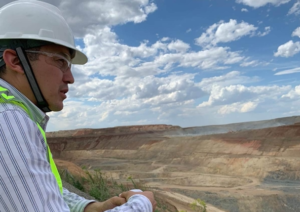 Figure 1 Detection of detrimental deformations |
AlmatyGeoCenter LLP is pleased to offer today a wide scope of deformation monitoring services for subsoil users and construction companies. Among these are the following:
- Obtaining information on facililties deformations caused by temperature fluctuation, wind effect and change in loads.
- Detection of the deformation propagation direction. Determination of verticality deviations and torsion of structures.
- Data analysis and interpretation aimed at detecting detrimental deformations in order to prevent further damage to the facility or avert a disaster (Figure 2). Data analysis enables to determine the change in the spatial position of key points of the facility in time, as well as to prevent overload on the facility and streamline the operational work.
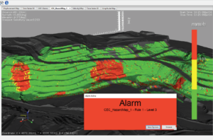 Figure 2 Prevention of damage to the facility |
Systematic mine surveying and geodetic observations arranged enable to avert disasters, minimize losses and avoid casualties – this is a key part of risk management, which is used for monitoring of complicated engineering facilities. The facility monitoring is possible both during the facility construction and during its subsequent operation.
In today’s world, the number of oil and gas fields and open pits is increasing (Figure 3). Increasingly complicated design of engineering facilities raises, surely, the risk of man-made emergencies. It shall be also borne in mind that many facilities are located in earthquake-prone areas.
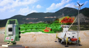 Figure 3 Geodynamic observations at borrow pits |
What facilities are usually subject to geodynamic observations? Bridge crossings, high-rise buildings, borrow pits, natural landscapes (earthfalls and mudflows), tunnels and mines, railway tracks, dams and dykes.
A large number of engineering facilities are designed with disregard for today’s requirements for seismic impact. Structures ageing and accumulation of deformations during the long-term operation lead to changes in the physical and mechanical properties of materials, of which the facilities are constructed, and bedding soils. Any engineering facility is also characterized by the so-called “self-induced vibrations”, the frequency of which depends on the structural design features of the members of the facility, the materials used and a number of other factors.
Deformation monitoring enables to record any deviations from the design values even the most insignificant ones (not to mention serious ones caused, for example, by natural disasters). Continuous monitoring of deformation processes contributes to before-the-fact prevention of resulting risks and taking the necessary measures to prevent accidents. Continuous deformation monitoring is an efficient investment protection instrument.
ПодробнееGeotechnical laboratory
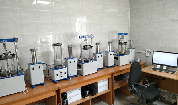
Geotechnical laboratory of AlmatyGeoCentre LLP carries out soil tests and determines their physical, hydrophysical, mechanical and chemical properties.
Basic physical, hydrophysical and chemical properties that are generally used in constructiona are as follows:
– natural moisture content;
– plastic limits;
– liquidity index;
– soil grading;
– bulk density;
– natural void ratio;
– permeability coefficient;
– groundwater chemistry;
– salt content of soils;
– groundwater and soil aggressiveness to metals and concrete;
Our geotechnical laboratory determines a wide range of soil mechanical properties using the highly sophisticated automated equipment.
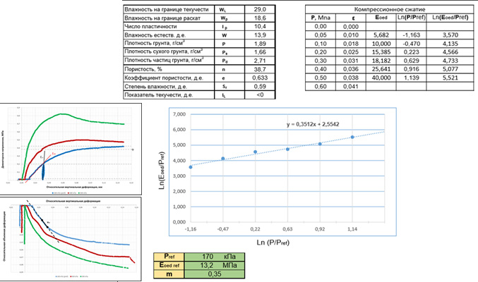
Compression
Soil sample compression in the odometer with freely drainable pore liquid. This test is used to determine the deformation properties of soils, such as the modulus of total deformation, the modulus of elasticity, as well as the coefficients of primary and secondary consolidation.
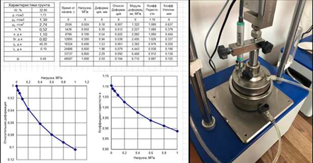
The principle attraction of the test lies in the simplicity of its preparation and execution, however, it has the disadvantage of impossibility of the lateral expansion in the odometer and, as a consequence, lack of lateral strain monitoring. In view of this, the results of deformation modulus determination shall be corrected based on the results of other laboratory methods or field tests.
Single-plane shear test
Direct shear test of soil samples is the most common and the most important method used to determine the soil strength. The analysis of bearing capacity of foundation soils of buildings and structures is based on the soil strength. Also, the value of the angle of internal friction and specific cohesion are the most important parameters, without which it is impossible to estimate the stability of slopes, fills, dams, open pit walls, etc.
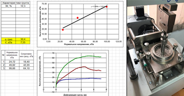
Our geotechnical laboratory is testing soils by the in-plane shear method according to the following procedures:
unconsolidated undrained procedure (quick shear test for unstabilized soil) – strength parameters shall be determined at overall stresses;
consolidated drained procedure (slow shear test for stabilized soil) – strength parameters shall be determined at effective stresses.
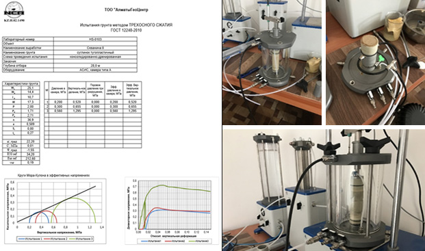
Triaxial compression test of soil
Stabilometer test is the most accurate method used to determine the strength and deformation properties of soil. It is possible to monitor the principal stresses practically independently, measure volumetric deformations, control drainages, create and measure pore pressure during the test, which allows to obatain a wealth of information about the soil behavior at various loading paths.
Interpretation of test results for nonlinear analysis in PLAXIS/MIDAS software packages
Software packages with modern soil models such as the Hardening Soil, the top range nonlinear model of soil behavior, are now rapidly gaining popularity. A fairly large number of laboratory tests are required in order to provide such a model with high-quality input data, however, saving in construction expenses due to more precise analysis may be repaid many times over.
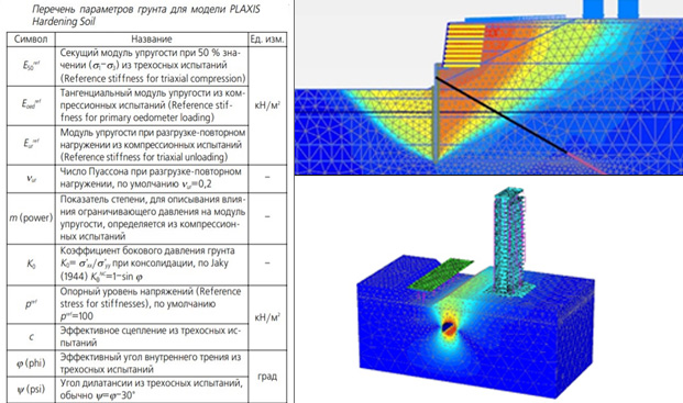
Our geotechnical laboratory conducts tests and provides interpretation of their results to be used in modern nonlinear models of soil behaviour.
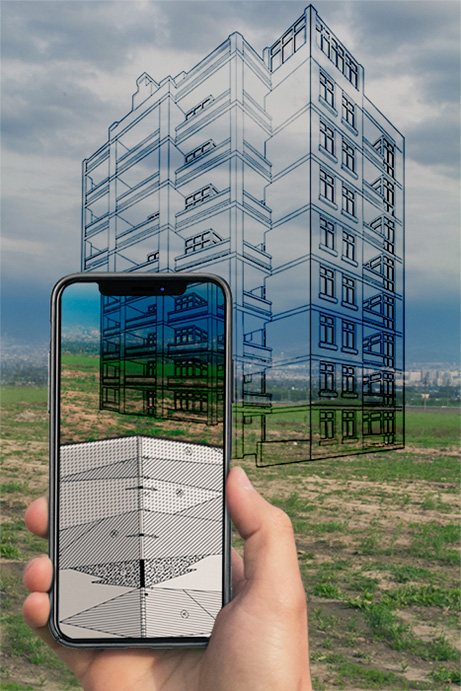
Laser scanning: creation of digital twins
Laser scanning is a technology of the measurement of distances and angles to the points of laser beams reflections and the calculation of the coordinates of these points. The result of laser scanning is points cloud which is then used to build spatial 3D models of the object.
There are 3 types of laser scanning:
1. Terrestrial Laser Scanning – performed from a static installation. This type is suitable for enclosed spaces, complex structures and internal surveys. It is used in geodesy and mining geodesy, construction and operation of engineering structures, architecture, industry, road infrastructure construction, monitoring of buildings and structures, etc.
2. Airborne Laser Scanning is carried out from an aircraft. This type of survey is very well suited to hard-to-reach and hazardous sites, and also has a significant advantage over standard aerial photography by effectively measuring the topographic height and density of vegetation.

3. Mobile Laser Scanning (MLS) – Depending on the subject to be surveyed, the laser scanner can be mounted on a land, water or other medium. MLS is predominantly used for surveying roads, railways, bridges and other objects in the terrain.

Field testi
Field testing is the most accurate way to determine the actual in-situ properties of soils for construction purposes.
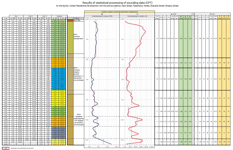
Cone Penetration Test (CPT)
Cone Penetration Test (CPT) shall be conducted for sandy-clayey soils in order to determine their physical and mechanical in-situ properties. A CPT is a slow pushing of a cone penetrometer into the ground using electronic sensors for recording the point resistance (qc) and side friction (fs).
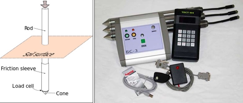
This type of sounding technique is mandatory in the design of friction piles, and is also perfect for all sites with loose sandy-clayey soils due to the quick acquisition of information.
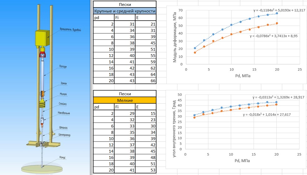
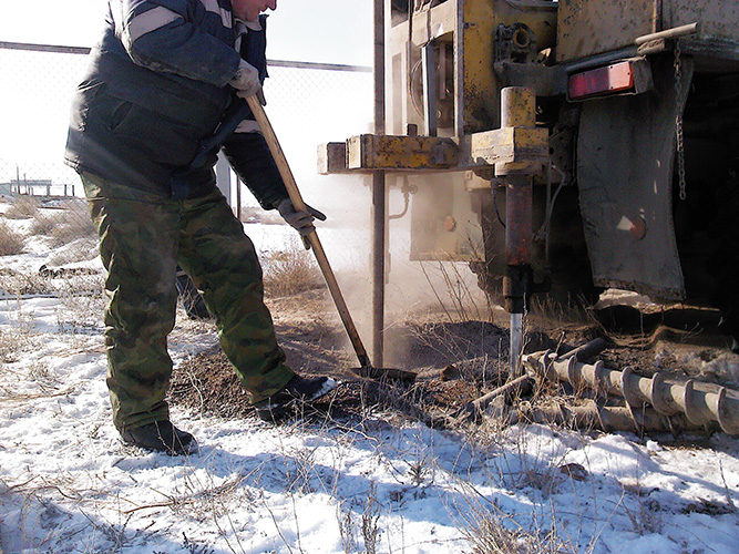
Dynamic penetration test (DPT)
Dynamic penetration test (DPT) is a cone tip driving into the ground by a weight (hammer) dropped freely from a height with recording the number of blows per each interval of penetration depth. A DPT is a simple and reliable way to determine the density and strength of sandy and gravelly soils, as well as to assess the sand liquefaction probability under earthquake effects.
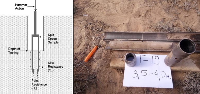
Standard Penetration Test (SPT)
Standard Penetration Test (SPT) is a type of dynamic sounding technicque that is of considerable current use in international geotechnical practice. The sounding technicque of this type is performed during borehole drilling at specified intervals. A SPT probe, a split spoon sampler, shall be installed at the borehole bottom to be driven by hammer blows down to a depth of 0.45 m. After that, the borehole shall be drilled to a predetermined depth and the test shall be repeated.
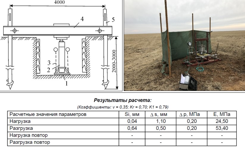
Static plate load tests
Field screw plate load tests and flat plate load tests are the main and the most reliable methods for determining the deformation properties and analysis of actual yield of the building foundation. If SP RK 1.02-102-2014 and SP RK 1.02-105-2014 of the Republic of Kazakhstan are used during the survey, then this test shall be part of work for facilities of increased and standard importance level (with assumed loads on the foundation soils of more than 250 kPa).
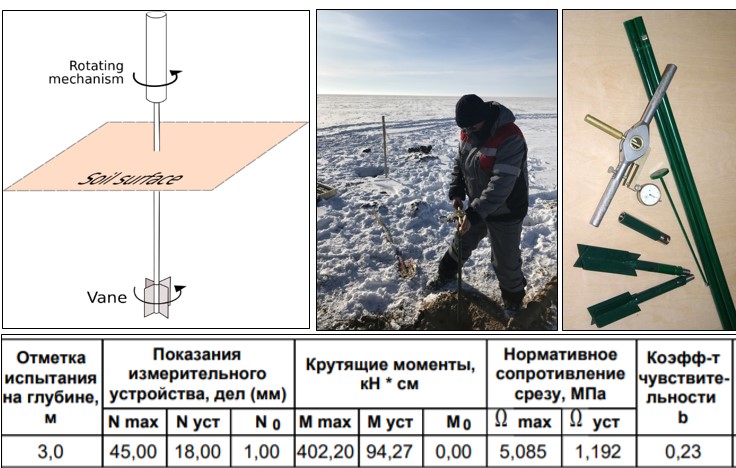
Weight Sounding Test (WST)
Weight Sounding Test (WST) is used to determine the strength properties: soil shear strength, soil undrained shear strength and to assesses the spatial strength variability of clayey soils, organo-mineral soils, and organic soils, including those with mactrofragmental inclusions measuring 2-10 mm, the mass of which does not exceed 15%. A WST is conducted under conditions of practically no drainage by application of horizontal tangential load and the soil displacement along a cylindrical surface arising as a result of vane rotation below the borehole bottom or in subjacent mass.
This method is perfect for very soft soils and liquefied soils as soil sampling and installation of shear strength apparatus in them is impossible.
Подробнее
Development of geoinformation systems
Geographic database
Up-to-date information resources are stored in databases. A geodatabase is the primary data format used to edit and manage the data, which consists of geographic information available in various formats in the geographic information system. Geographic information is used everywhere, in almost every aspect of industrial production and people’s daily lives.
Data may help improve the data management by providing the public with the more detailed information and support economic growth by enhancing resource planning system and thereby improving decision-making.
Geodatabases have a comprehensive information model to display and manage geographical information. This comprehensive information model is implemented by a series of simple data tables (Figure 1) containing spatial feature classes, raster sets and attributes.
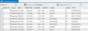
Figure 1 Table with data
Geodatabases come in different sizes, have different numbers of users and can scale from small single-user, file-based databases to larger workgroups, departments and enterprises that are accessed by many users.
The database design is based on series of data themes, each with a specific geographical representation. The geographical representations are arranged into series of datasets or layers (Figure 2). A set of themes works like a set of layers. The geodatabase can contain geographic data in four representations:
- Vector data to represent spatial objects.
- Raster data for network and surface data representation.
- Triangulated Irregular Networks (TIN) for surface representation.
- Addresses and rangers to find the geographical location.
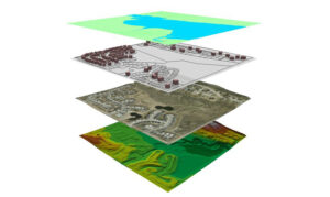
Figure 2 Thematic layers
The advantage of the geodatabase is as follows:
- The way data are stored and processed.
- Data access rights.
- Data storage capacity.
Geodatabases (Figure 3) are the backbone of spatial data infrastructure. Their content cannot be reduced to geographic information only. It is much broader than that. Geodatabases are the basis for storing spatial information resources and the basis for generating new information resources.
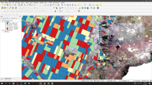
Figure 3 Geodatabase
AlmatyGeoCentre LLP provides geodatabase development services. The range of their application today is immense. Data is an integral part of professional activity of a modern person, so it is very important to process it efficiently. Unified placement and protection of all types of information helps to significantly reduce the cost of storage devices.
Geodetic aerial photography
For Aerial Imagery we use Geoscan-201 unmanned aerial vehicles (UAVs) and DJI Phantom4 drones. Our aerial surveyors are licensed as remote pilots and each flight shall be authorised by the Civil Aviation Committee. Our aerial surveyors have extensive experience in various projects.
Our aerial surveys:
– Aerial Imagery of the city of Kapchagai in order to expand the boundaries of the city;
– Aerial Imagery of the lands added to the city of Almaty;
– Aerial Imagery of the Kacharsky open pit and dumps in the Kostanay Oblast;
– Aerial Imagery of the villages of Lepsy, Koktuma, Beskol, Zhaipak, the coast of the lake Alakol for master plans development;
– Aerial Imagery for construction of the Pokatilovsky water reservoir on the Baskan River with the barrage power station in the Almaty Oblast;
– Engineering and geodetic surveys – Aerial Imagery on a scale of 1:2000 for development of master plans of settlements and Detailed Planning Design in Almaty Oblast for 2015 (5 villages of Kerbulak Raion);
– Aerial Imagery of the surface and previous boreholes referencing at the Samarskoye deposit in the Karaganda Oblast using unmanned aerial vehicles (UAVs). Samarskoye deposit in the Karaganda Oblast, and many other projects.
During Aerial Imagery we use a GNSS receiver on board the drone. It allows achieving an accuracy of UP TO 5 CENTIMETERS, depending on the accuracy requirements. Below are part plans of survey images of different accuracy:
IMAGE WITH 3 CM ACCURACY

IMAGE WITH 5 CM ACCURACY
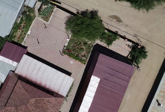
IMAGE WITH 10 CM ACCURACY
IMAGE WITH 20 CM ACCURACY

SATELLITE IMAGE WITH 50 CM ACCURACY

(THE SAME IMAGES WILL BE ATTACHED AS A POWER POINT FILE)
Aerial images may be used as a standalone product, for example, for viewing large areas. Also, these data may be used for the following:
– Aerial surveys for creating a 3D terrain model
– Aerial survey for topographic mapping
– Aerial survey for regular monitoring of earthworks
Подробнее
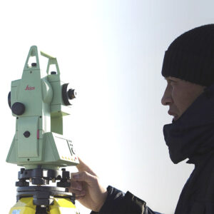
Geodetic support of construction
Our specialists have wide experience in supporting the construction of highways, construction of plants and special industrial facilities.
We focus on two main tasks:
- Maintain high accuracy when setting out the project;
- Well-timed issuance of as-built survey documents.
To accomplish the first task, we use high-precision geodetic equipment with an angular error of 1 second. If necessary, we also use a level and a dual-frequency GPS receiver.
For well-timed issuance of as-built documents, our team of surveyors has implemented and is using a project management system. Thanks to the task manager and the project management system, at any time we clearly know what process will begin on construction site and when this process will begin and what work we need to do in order not to delay the construction. As a result, our team of surveyors always develops and issues the required documentation before the deadline. If the client has the updated construction schedule, then we synchronize our processes and tasks with the main schedule, and as a result, everything works like a Swiss clock. Then the work goes smoothly, without delays, if deviations appear, then they are eliminated in a split second. As a result, the following companies work with us:
In addition, we pay special attention to occupational safety. Our surveyors always use personal protective equipment. We believe that the quality of project management directly affects the success of the project.


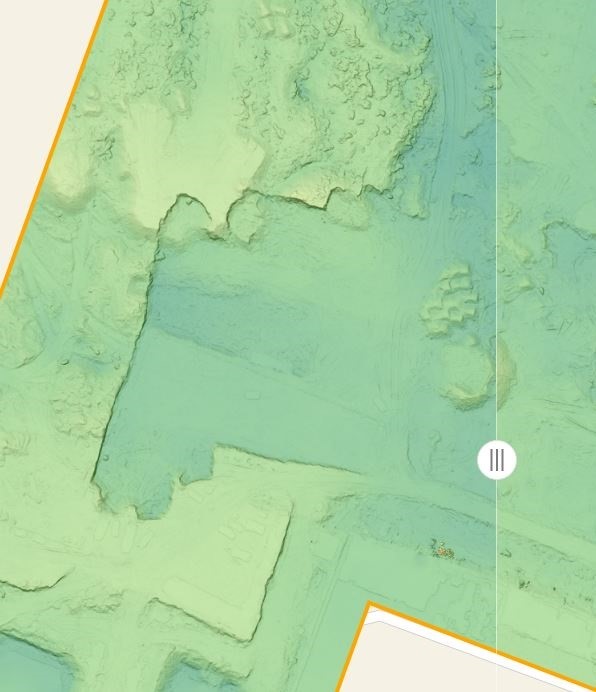
Calculation of earthwork quantities and remote aerial monitoring of open pits
We offer two options for regular earthwork measurements:
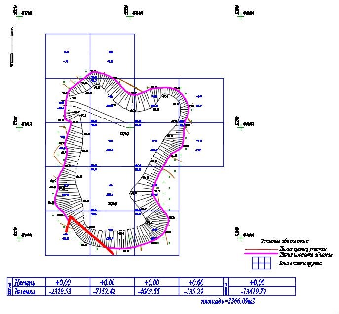
- The classic method with the use of geodetic GPS instruments or tacheometer. A detailed topographic survey of representative points of the relief is carried out, after which the cut and fill are calculated using the software method. An example of the result of the work is below.
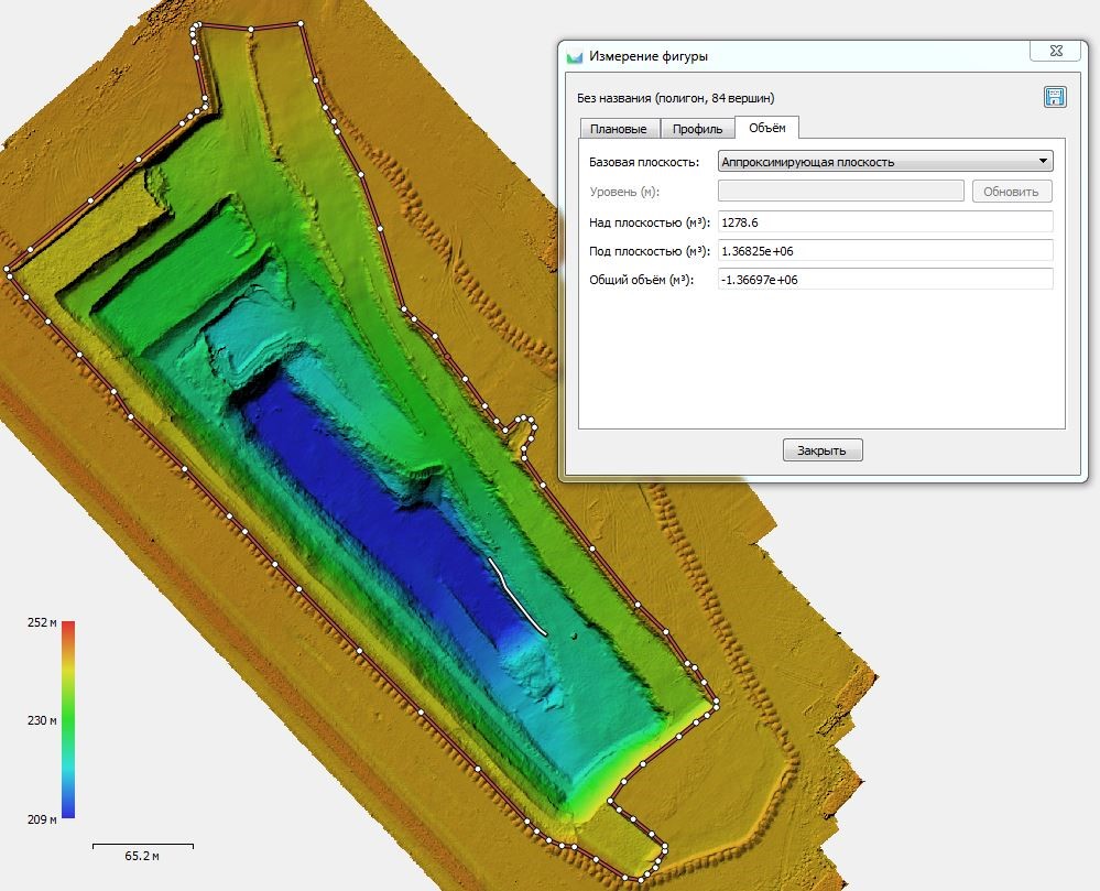
- Method with the use of Aerial Imagery. This method is more accurate, since when shooting from a drone, we get a surface not only by representative points of relief, but a dense cloud of points by which the calculation is made. An example of the result of the work is below:
In addition to the measurement accuracy, this method is cheaper to perform and it can be conveniently organized into an online platform with the ability to make measurements between two shooting dates while being in the office. Online platform for earthwork monitoring, in addition to earthwork quantities measuring, allows to download the design model and compare the current state with the project, draw longitudinal profiles on which the current and design elevations will be indicated, measure areas and distances; and take coordinates directly from the image. In addition to these capabilities, the system will allow storing all taken aerial images in a non-random manner and being arranged chronologically by the dates of flights, you will be able to switch easily between the dates of flights and measure the progress of the work performed. Practice shows that such control of contractors reveals inaccuracies in calculating the volume of soil; as a result, the client fully returns the costs of aerial monitoring and reduces costs.
Our services include:
– Weekly Aerial Imagery of the work site;
– Compilation of orthophotomaps and simulation of digital site model;
– Weekly as-built survey of the site of the work performed.
We named this approach as “Remote aerial monitoring” and offer it to our clients as an additional option. Remote aerial monitoring suits well for monitoring large facilities, such as open pits, dumps, tailings storage facilities.
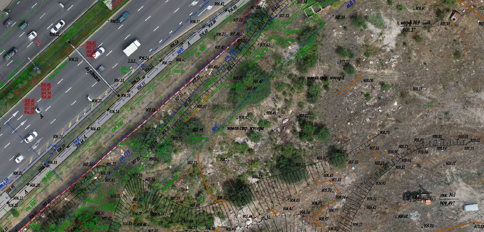
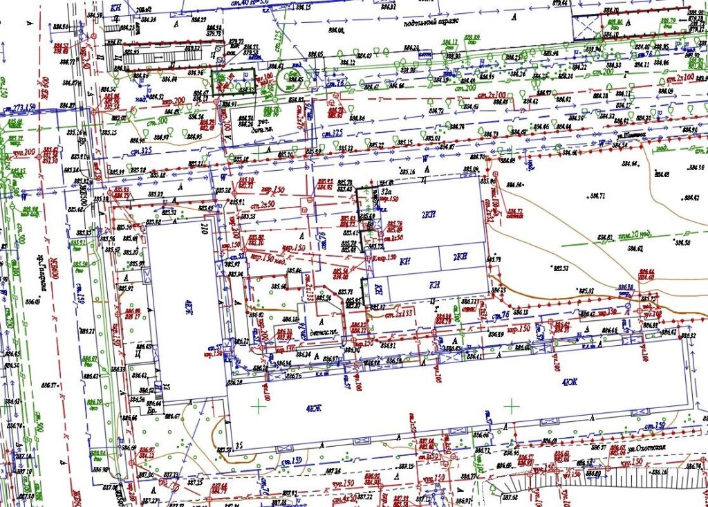
ПодробнееTopographic Survey
Topographic survey is what we started out from.
Since 2009 till now, topographic survey is considered to be one of our main activities. Since 2009, we have gained experience in conducting topographic surveys for civil and industrial projects.
We carried out topographic surveys for industrial projects: topographic surveys for development of rotation villages, topographic surveys of open pits, topographic surveys of dumps at the deposits, topographic surveys for design of highways and topographic surveys of railways and railway stations.
Also, our specialists have wide experience in performing topographic surveys for civil construction: topographic survey performing for drawing up master plans of settlements, topographic survey of lands added to a city, topographic survey of intra-city sites and utilities.
Now our team of surveyors employs people who have gained all the experience of the company since 2009 and constantly raise their competence. We also offer our clients a topographic survey being performed according up-to-date technologies that allow us to achieve an accuracy of up to 1 mm both in plan-view and height.
Why choose us?
– We do not focus on money, we strive for challenge to be successfully met and do our best to exclude problems that may arise in the future;
– We use all our experience gained to accomplish your tasks;
– We guarantee that our work will be done well and we are responsible for it even after signing the certificate of completion;
– We value our deserved reputation, so we do our best to keep the client always satisfied;
– We have assembled a team of surveyors who love their job … at least they say they do 🙂
engeo.kz
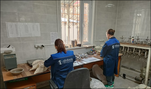
The engeo.kz portal is the first and only database of geotechnical surveys in the Republic of Kazakhstan. Engeo.kz is part of the Alidada group of companies.
engeo.kz mission is “to establish the user-friendly geotechnical information database and make it available to everyone”
The main criteria for better quality of construction are the reliability and adequacy of results of geotechnical surveys. Besides, at the start of construction, availability of materials and previous surveys’ data (archival materials) are important for both the Designer and the Surveyor. The availability of previous surveys’ data for the area to be developed makes it possible to describe the current geological processes more accurately. But the main problem with archival materials is that they are not currently collected in a single fund. To meet the challenge of establishing the unified fund of materials for geotechnical surveys, we have created the innovative product – “engeo.kz – Engineering Geology of Kazakhstan”.
Advantages of the project:
– Geotechnical data being collected throughout the Republic of Kazakhstan;
– Boreholes of geotechnical surveys drilled from 1991 to present;
– Monthly updating of data;
– Prompt receipt of information in a couple of clicks;
– Complete information on a borehole: borehole location, year and method of drilling, diameter of drilling, borehole depth; borehole log with description of a geotechnical section; laboratory soil test data; field soil test data (SPT, DPT, CPT).
This product was created for special benefit of design companies, design institutes, construction companies; real estate developers; companies engaged in geotechnical surveys, as well as for research purposes, for higher educational establishments (universities, etc.).
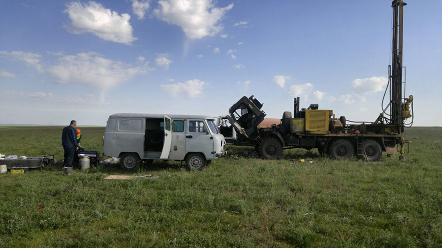
Geological Prospecting Work
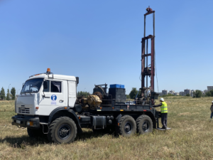
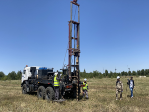
One of our main areas of focus is prospecting drilling for solid minerals.
We offer three types of drilling:
– Core drilling up to 800 metres deep. Boyles C6 machine is used, year of manufacture: 2021;
– RC drilling up to 200 metres deep. SP4500A-RC with Johnson riffle is used;
– Core drilling with hydraulic core lifter up to 100 metres deep. URB 2A2 machine is used.
Despite the fact that all equipment is in excellent working condition, we have created a warehouse for spare parts and drilling tools in preparation for sudden breakdown situation. An experienced driller is well aware that even new equipment can fail at the most crucial moment. Therefore, we made such a decision and this idea worked. We always focus on the quality of management in the course of work. We have created a convenient client relationship system where the client is always updated about the work process and receives regular reporting. We have also introduced an up-to-date project management method that helps to track the project at any given time. In addition, we pay special attention to occupational safety. Our drillers always use personal protective equipment. We believe that the quality of project management directly affects the success of the project.
Hydrogeological surveys
Our team of hydrogeologists performs hydrogeological work related to the assessment of groundwater resources, stability, water quality and water supply. Our clients are mainly ore mining plants and industrial sector.
We carry out the following types of work:
– Development of hydrogeological survey projects;
– Drilling of hydrogeological boreholes including geophysical well logging;
– Groundwater inflow testing;
– Installation of piezometers;
– Laboratory works;
– Preparation of Hydrogeological Surveys Report.
We always focus on the quality of management in the course of work. We have created a convenient client relationship system, where the client is always updated about the work process and receives regular reporting. We have also introduced an up-to-date project management method that helps to track the project at any given time. In addition, we pay special attention to occupational safety. Our drillers always use personal protective equipment. We believe that the quality of project management directly affects the success of the project.
Geotechnical surveys
Our team of geologists has gained wide experience since 2009. We drilled boreholes for construction of railways and stations in the Western Kazakhstan, carried out surveys for designing of tailings storage facilities and dumps in the Central Kazakhstan, worked under hard conditions in Astana where geological profiles include variegated soils and under hard seismic conditions in Almaty. Complex and non-standard projects, as well as projects to be carried out according to Eurocodes are of interest to us. Our specialists speak English and we are able to implement projects according to European or North American ASTM standards. Our geologists are considered to be among the best in the labor market. It may sound pompously, but it is true. We try to engage the best ones, as the cost of a geotechnical error is high. We value this team and constantly try to raise their technical competence. Our geologists study sophisticated software proposals and advanced methods of in situ soil tests. Our own accredited laboratory has the latest developments in triaxial compression, uniaxial compression / tension tests and automated compression instruments. The Geotechnical Department development is focused on the study of soils behaviour and impact that buildings under construction have on the geological subbase. In our geotechnical laboratory, we obtain soil data that ,may be used in modern stability analysis software such as Plaxis or Midas.
Projects where we have been involved in:
| 2020-2021
|
Engineering surveys within the framework of “Rehabilitation of Kacharsky open-pit involving the southern section of the deposit by increasing the open-pit output to 26 million tons of ore per year” Project |
| 2019-2020
|
Geotechnical surveys within the framework of “Rehabilitation of tailings storage facilities of Aktobe Copper Company LLP to ensure operation until 2030” Project
|
| 2020-2021
|
Engineering surveys within the framework of projects:
1. Improvement of the process of treatment of sludge tailings of Donskoy Concentrator Slime – 2 2. Construction of tailings flotation area of a sludge treatment plant Construction of sludge treatment plant, Donskoy Concentrator, Khromtau
|
| 2018-2020
|
Engineering surveys within the framework of projects:
1. Construction of a gold processing plant with an output of 3 million tons per year for gold ore treatment on the basis of the existing Aksu Mine Gold Processing Plant 2. Construction of a crushing and grading plant and a mechanical repair shop at the Dolinnoye deposit 3. Construction of the Dolinnoye Gold Processing Plant using CIP technology 4. Construction of a new plant with an output of 2 million tons of ore within the territory of the Pustynnoye Gold Processing Plant using CIP technology 5. Increase of throughput capacity of the Pustynnoye Gold Processing Plant up to 3 million tonnes of ore per year for combined ore processing “Expansion (renovation) of existing tailing storage facility to a distance up to the end of the Bozshakol deposit mining”
|
| 2019
|
Geotechnical surveys and mapping within the framework of “Construction of 50 MW Solar Power Plant” Project
|
| 2019
|
Geotechnical surveys and mapping within the framework of “Construction of 100 MW and 50 MW Wind Farms” Project
|
| 2018
|
Geotechnical survey within the framework of “Construction of Integrated Gas Chemical Complex (IGCC) in the Atyrau Region” Project
|
| 2018
|
Geotechnical and engineering-hydrogeological surveys for “Aktogay Expansion Project”
|
| 2018
|
Geotechnical and topographical surveys for
“Construction of a 50 MW Wind Farm in the Shelek Corridor” Project
|
| 2018
|
Geotechnical surveys for the design and construction of a tailing storage facility and a storage pond of the concentrator for extraction and processing of polymetallic ores of the Alaigyr Deposit |
| 2017
|
Geotechnical surveys and mapping within the framework of “Construction of new railway tracks along the route: Beineu – Bozoi station, with a total length of 250 km” Project
|
| 2016
|
Geotechnical surveys and mapping at “Almaty 1 – Otar (incl.) railway section for development of a detailed design for Facility “Construction of second tracks on Almaty 1 – Shu ” railway section
|
| 2016
|
Geotechnical surveys for the first, second, third and fourth (main) start-up facilities of the Integrated Chemical Complex under ‘”Production of glyphosphate (herbicide) and “Production of phosphorus trichloride” in the Chemical Park Taraz FEZ” Project
|
| 2015
|
Geotechnical surveys within the framework of “New transport system of the city of Astana LRT (a section from the airport to the new railway station, 22.4 km)” Project
|
| 2011 | Geotechnical surveys at the stage of Feasibility Study for “Construction of Astana-Almaty high-speed railway line” facility |
In addition to day-to-day operations, our company initiated establishment of association of legal entities “Kazakhstan Association of Geotechnical Companies”. The Association aimed to unite large operating geotechnical enterprises and address industrial issues of immediate concern through joint efforts. We consider this to be an important activity, though it does not yield a profit. This activity is effective in the long run and will be fruitful over the years. We expect to improve the quality of construction in Kazakhstan by addressing issues such as introduction of mandatory expert review of geotechnical survey reports, introduction of categories in the licenses of geological companies and other initiatives. Every effort of the Association is aimed at improvement of construction quality, so that our children would be able to live in high-quality houses and study in durable school buildings.
Why choose us?
– We conduct tests in our own laboratory, this allows us to control the process fully and monitor the quality of results;
– We conduct soil tests using field test methods; such tests as SPT, CPTu, DPT, PLT that provide a complete picture of geotechnical conditions on a construction site;
– We prefer complex projects and plunge headlong into the search for a solution to the problem;
– We carry out work according to Eurocodes, as well as European and North American ASTM standards;
– We always esteem our clients and make pleasant presents))
Подробнее