
Calculation of earthwork quantities and remote aerial monitoring of open pits
We offer two options for regular earthwork measurements:
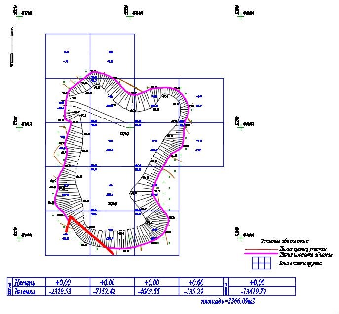
- The classic method with the use of geodetic GPS instruments or tacheometer. A detailed topographic survey of representative points of the relief is carried out, after which the cut and fill are calculated using the software method. An example of the result of the work is below.
- Method with the use of Aerial Imagery. This method is more accurate, since when shooting from a drone, we get a surface not only by representative points of relief, but a dense cloud of points by which the calculation is made. An example of the result of the work is below:
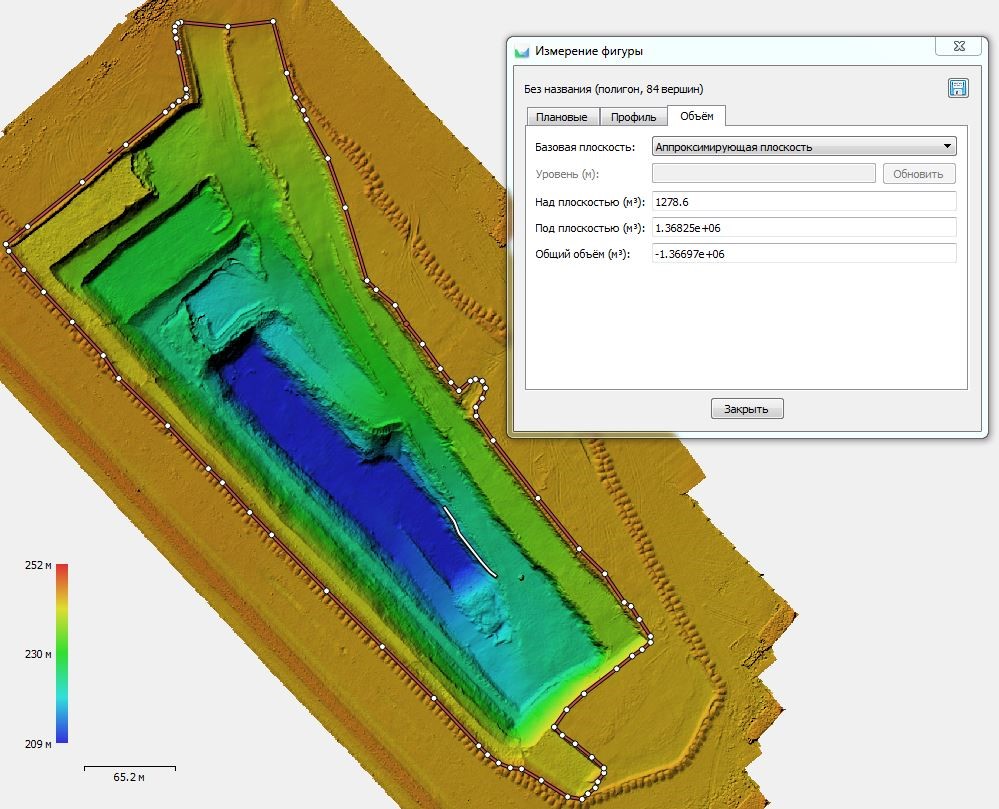
In addition to the measurement accuracy, this method is cheaper to perform and it can be conveniently organized into an online platform with the ability to make measurements between two shooting dates while being in the office. Online platform for earthwork monitoring, in addition to earthwork quantities measuring, allows to download the design model and compare the current state with the project, draw longitudinal profiles on which the current and design elevations will be indicated, measure areas and distances; and take coordinates directly from the image. In addition to these capabilities, the system will allow storing all taken aerial images in a non-random manner and being arranged chronologically by the dates of flights, you will be able to switch easily between the dates of flights and measure the progress of the work performed. Practice shows that such control of contractors reveals inaccuracies in calculating the volume of soil; as a result, the client fully returns the costs of aerial monitoring and reduces costs.
Our services include:
– Weekly Aerial Imagery of the work site;
– Compilation of orthophotomaps and simulation of digital site model;
– Weekly as-built survey of the site of the work performed.
We named this approach as “Remote aerial monitoring” and offer it to our clients as an additional option. Remote aerial monitoring suits well for monitoring large facilities, such as open pits, dumps, tailings storage facilities.